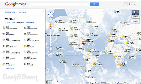
Ever wish you could know the weather conditions at your destination before you arrive? Well now you can with Google Maps. The Google Maps weather feature shows real time weather conditions as well as an extended forecast.

Activate Weather on Google Maps
To turn on weather conditions with Google Maps, follow these simple steps:
- Navigate to http://maps.google.com
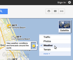
- Click on the widget in the upper right hand corner of the map screen and select weather.

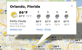
- Zoom in or out on the location you’re interested in, then click on the icon next to your location to see current and extended weather conditions.

You can adjust the weather settings for °C or °F and still use other options like traffic in combination with the weather overlay.
This feature can come in handy when business traveling or while on vacation. For example, if you commute to Chicago you can check the weather and if it’s raining, then you’ll know to take an umbrella or better pair of shoes. While on vacation, let’s use Orlando, FL as an example, you’ll be able to check the weather around Disney and Universal to see which one is having showers or is comfortably shaded from the summer heat. Going to the beach? You wouldn’t want to arrive at Daytona only to find out it’s raining.
There are a number of other uses such as checking weather conditions near a relative during a major weather event or across the globe, but either way there’s no excuse to not be prepared for the weather anymore.
Your Thoughts
What do you think of the weather feature in Google Maps? Have you used it for more than trips? Let us know in the comments!

